

Table of Contents
Why Are the Clouds So Low: A Guide to Cloud formations and Weather
Have you ever looked up at the sky and wondered what type of clouds you were seeing? Or why they were so low? In this article, we will answer those questions and more! We’ll provide a guide to cloud formations and weather, so that next time you’re looking at the sky, you’ll be able to identify the different types of clouds and understand what they mean to the weather.
Clouds And How They Form
Clouds are made up of tiny water droplets or ice crystals. The air around us is full of these particles, but they only come together to form clouds when the right conditions are present.

This process is what creates cumulus clouds – those fluffy white puffs you see in the sky on a summer day. The rising air cools and forms the water droplets that make up the cloud. As long as there’s enough moisture in the air, this process can keep going and the clouds can grow taller.
Clouds Form in Different Ways
Clouds can form in a variety of ways, depending on the weather. For example, if there is a lot of moisture in the air, the clouds will be low and thick. If there is less moisture, the clouds will be higher up in the sky.
The type of cloud also depends on the temperature. If it is warm, the clouds will be fluffy and white. If it is cold, the clouds will be thin and wispy.
Types of Low Clouds
There are three primary types of low clouds – stratus, stratocumulus, and cumulus.
Stratus clouds are generally very thin, uniform layers covering the entire sky. They appear as a grayish sheet with no defined shape and can bring light rain or drizzle and usually form when cool air near the ground is lifted by warm air aloft.
Stratocumulus clouds are also low-level Clouds, but they are not as uniform in shape or thickness as stratus clouds. They often appear as large puffy masses or sheets with darker areas between the cloud patches.
Cumulus clouds are low-level Clouds that are often described as “puffy” or “fluffy.” They tend to have sharp edges and well-defined shapes, unlike stratus and stratocumulus clouds. They are generally white, but can sometimes appear gray or even black. Cumulus clouds usually form in the daytime when the sun heats the ground and causes thermal updrafts that lift the moist air.
But also there are some other types of low clouds- altocumulus and nimbostratus.
Altocumulus clouds are middle-level Clouds that often appear as thin, white, fluffy patches. They can sometimes be mistaken for cirrus clouds, but they lack the wispy, stringy appearance of cirrus clouds.
Nimbostratus clouds are dark, grayish-black Clouds that cover the entire sky. They often bring continuous light to heavy rain or snow and usually form when a warm front moves through an area.
Clouds You Should Know About
Cumulus
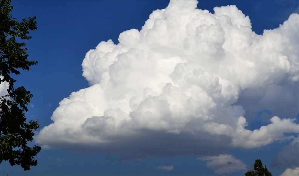
Cumulus clouds are the puffy, white clouds you see in the sky on a beautiful summer day. They’re often compared to cotton balls or popcorn, and they form when warm air rises. These types of clouds generally don’t produce precipitation, but if they grow large enough, they can turn into thunderstorms. They can also produce virga, which is when rain falls from the cloud but evaporates before it hits the ground.
Cumulus clouds are generally found in the fair-weather cumulus family. This means they form in areas of low pressure and tend to be fairly short-lived. However, there are some types of cumulus clouds that can indicate dangerous weather conditions, including thunderstorms. If you see a large cumulus cloud that’s growing vertically, it could be a sign that a thunderstorm is brewing. [1]
Cumulonimbus
These clouds can dissipate within an hour or two. They are very low-lying and may be a few hundred feet above the ground.
Cumulonimbus clouds are often associated with bad weather, but they can actually occur in any type of weather system. The main difference between these clouds and other types is their size and shape. Most cumulonimbus clouds are much larger than other types of clouds and have a flat base with a round top.
Cumulonimbus clouds are capable of producing severe weather, including heavy rain, strong winds, hail, and even tornadoes. These clouds are often found in the same general area as thunderstorms. If you see a cumulonimbus cloud, it is best to take shelter immediately. They are also known to cause flight delays and cancellations.
Cirrus
Cirrus clouds are usually the first sign that a big storm is brewing.
They are long, thin, and wispy, and they often look like streaks or curls in the sky. They’re made up of ice crystals, and they generally form at high altitudes-usually above 20,000 feet.

Cirrus clouds can be a sign that bad weather is on its way. If you see cirrus clouds early in the day, it could be an indication that a thunderstorm will develop later on. Cirrus clouds also tend to precede hurricanes and other large storms. They can also give you a clue as to how severe a storm might be. If the cirrus clouds are thick and widespread, it’s likely that the storm will be fairly large and intense.
On the other hand, if you see just a few wispy cirrus clouds, it probably won’t be a very big deal. So, if you’re trying to decide whether or not to pack an umbrella, take a look at the sky and see what kind of cirrus clouds are up there.
Cirrostratus
Cirrostratus clouds are another type of cloud that can indicate bad weather is on its way. They are thin and spread out, like cirrus clouds, but they tend to cover the entire sky. Cirrostratus clouds are made up of ice crystals, and they usually form at high altitudes.
When you see cirrostratus clouds, it’s a good idea to keep an eye on the weather forecast. If the forecast calls for precipitation in the next few hours or days, it’s likely that the cirrostratus clouds are a sign of an impending storm.
Nimbostratus
Nimbostratus clouds are usually a sign of rain or snow. If you see nimbostratus clouds, it’s a good idea to check the forecast to see if precipitation is in the forecast.
Stratus
Stratus clouds are low, horizontal layers of clouds. They can be either thin or thick, and often cover the entire sky. These clouds are usually gray or white and sometimes have a blue tint. Stratus clouds can produce light rain or snow.
Stratus clouds form when the air is cool and stable. The air above the ground is cooler than the air higher up in the atmosphere. This creates a layer of warm air that acts as a lid, preventing the cool air from rising any higher. As the cool air continues to move horizontally, it eventually forms into stratus clouds.
Lenticular
These clouds can often be seen near mountains. They are called “lenticular” because they have a lens-like shape. Lenticular clouds are usually stationary, but can sometimes be seen moving when the wind is blowing.

Lenticular clouds are created when the air near the ground is forced to rise up over a mountain. As the air rises, it cools and condenses into water droplets.
The height of the cloud depends on the altitude of the mountain and the strength of the wind.
Lenticular clouds can often be seen in the same place for days or weeks at a time.
If you live in an area with mountains, you’ve probably seen lenticular clouds before.
Kelvin-Helmholtz Instability
The Kelvin-Helmholtz instability is a common cause of low clouds. It occurs when there is a difference in the speed of two air layers. The faster layer will push on the slower layer and create ripples on the surface. These ripples can eventually break off and form clouds.
Another cause of low clouds is an inversion layer. An inversion happens when the air near the ground is cooler than the air above it. This can happen on calm days when the sun heats up the ground faster than the air can cool it down. The inversion traps pollution and other particles near the ground, which can form into low clouds.
Also, low clouds can form when warm air rises and hits a cold layer of air. The warm air will cool down and condense into water droplets, which will form clouds. This type of cloud is often seen in the morning or evening when the temperature changes quickly.
Finally, low clouds can also be caused by meteorological phenomena such as frontal lifting or convective instability. Frontal lifting happens when a cold front moves in and lifts the warm air that was near the ground. Convective instability happens when the air near the ground is heated from below and starts to rise. This can cause cumulus clouds to form at lower levels than usual.
Why clouds are getting lower
The clouds are actually getting lower, on average, around the world. And this has been happening for a while. The main reason is that the air is warmer now than it used to be. And as the air warms up, it can hold more water vapor.

But why is the air warming up? Well, that’s because of us humans. We’re pumping more and more greenhouse gases into the atmosphere. And those gases are trapping heat and making the planet warmer.
So, in a way, we’re making our own weather. We’re changing the climate, and that’s changing the clouds. [2]
Of course, there are other things that can affect cloud formation, like volcanic eruptions. But on the whole, human activity is causing clouds to get lower around the world.
Why do low Clouds form?
There are a few different processes that can lead to the formation of low Clouds. The most common is when cool air near the ground is lifted by warm air aloft. This can happen in a variety of ways, such as when warm air rises over a mountain range or when warm air moves into an area ahead of a cold front. Low Clouds can also form when moist air near the ground is cooled to the point of saturation (100% relative humidity), either by contact with a colder surface or by mixing with drier air aloft. This process is known as “adiabatic cooling” and often leads to the formation of stratocumulus clouds.
But why are the clouds so low? The answer has to do with the way air moves around our planet. The Earth’s surface is heated unevenly by the sun. This causes warm air to rise at certain locations while cooler air sinks.
The rising warm air creates areas of low pressure, while the sinking cool air creates areas of high pressure. Air always flows from areas of high pressure to low pressure, which is why we have wind.
The winds caused by this temperature difference can be quite strong, and they help to push the clouds out of the way. That’s why you often see cumulus clouds being blown across the sky in a line.
But there’s another factor that can affect the height of clouds. If the air is already saturated with water vapor, it won’t be able to hold anymore and the water droplets will condense out at a lower temperature.
This is why clouds are often lower in the evening when the air has had all day to absorb moisture from evaporation. The same thing can happen on a cold, winter day when the air is full of moisture from your breath and you see fog instead of clouds.
FAQ
Why is the cloud so low?
The cloud is low because it is being forced down by the weight of the air above it. The air above the cloud is colder and heavier than the air below it, so it pushes the cloud down. This process is called convection.
Another reason why clouds might be low is that they are full of water droplets. When a cloud is full of water droplets, it becomes heavy and sinks lower in the sky.
Lastly, wind can also cause low-lying clouds. If there is a strong wind blowing from one direction, it can push the clouds to one side, making them appear lower than they actually are. [3]
What are the low-level clouds?
The low-level clouds are the clouds that are found at a lower altitude in the sky. They are also known as cumulus clouds. The cumulus clouds are generally white and fluffy in appearance. However, they can also be grey or black if they are carrying a lot of water.
The low-level clouds are found at an altitude of fewer than 2000 meters above the ground level. These clouds are generally formed due to the convectional lifting of air. When the warm air rises up, it cools down and condenses to form these low-level clouds. [4]
What determines how low a cloud is?
The main factor that determines how low a cloud is, is the temperature. When warm air rises, it will cool and the water vapor will condense into clouds. The higher the cloud, the colder it is. Therefore, clouds form at different levels depending on the temperature. For example, cirrus clouds are high up in the sky because they are made of ice crystals that form in very cold temperatures.
On the other hand, cumulus clouds are lower down because they are made of water droplets which form in warmer temperatures. You might see cumulus clouds on a hot summer’s day while cirrus clouds might be more likely to appear during winter.
What makes clouds higher or lower?
The main factor that determines the height of clouds is temperature. Warm air can hold more moisture than cold air, so warmer air rises higher, while colder air pushes clouds down. This is why you often see lower clouds on cooler days and taller clouds on hotter days.
Other factors that can influence the height of clouds include:
- The amount of moisture in the air
- The type of cloud (cumulus or stratus)
- Wind speed and direction
- Barometric pressure
All of these factors can interact with each other to create different cloud formations and weather patterns. [5]
Useful Video: Clouds so low
Conclusion
In conclusion, the clouds are low for a variety of reasons. The most common reason is due to the temperature and humidity in the air. However, other factors such as wind speed and direction can also affect cloud formations. By understanding why the clouds are low, you can better predict the weather and plan your activities accordingly. Thank you for reading! I hope this guide was helpful.
References:
- https://www.quora.com/Meteorology-What-factors-affect-how-low-the-clouds-are
- https://e360.yale.edu/features/why-clouds-are-the-key-to-new-troubling-projections-on-warming
- https://phys.org/news/2018-03-clouds-reveal-weather.html
- https://www.weather.gov/jetstream/basicten
- https://www.wfmz.com/weather/why-do-clouds-form-at-different-heights-in-the-atmosphere/