Weather station models can seem confusing at first, but with a little knowledge you can understand what all the lines and colors mean. In this comprehensive guide, we will answer some of the most common questions people have about weather station models. We’ll provide useful tips on how to read them and what to look for when forecasting the weather. So whether you’re a beginner or an experienced meteorologist, this guide is for you!
Table of Contents
Why is It Important to Read the Weather Station Model Properly?
Reading weather station models is important for a number of reasons. First and foremost, understanding the model can help you better understand the current weather conditions. Additionally, reading the model can also help you make predictions about future weather conditions. Finally, by reading the model, you can also identify any potential problem areas that may impact your local area.
Main Variables of Weather Station Models
To understand how to read weather station models, it is first important to understand the main variables that are used in these models. In this section, we will discuss all the main variables that you need to be aware of in detail.
Temperature
This variable tells us how hot or cold it is outside. The temperature can be measured in degrees Fahrenheit (°F), Celsius (°C), or Kelvin (K).
Weather station reads temperature by checking the kinetic energy of particles in the air. The hotter the air, the more kinetic energy the particles have. The colder the air, the less kinetic energy the particles have.
Now when it comes to reading temperature from a weather station model, you need to pay attention to the upper left-hand corner of the model. In this corner, you will see a number. This is your temperature. The exact unit of measurement won’t be shown, but will be based on the country of origin for the model. For example, in the United States, the temperature will be shown in degrees Fahrenheit (°F), but in Europe it will be shown in degrees Celsius (°C).
If you live in another region, you can easily convert the temperature to the unit of measurement that you are most familiar with. For example, if you live in Europe and the weather station model is showing the temperature in degrees Fahrenheit (°F), you can convert it to degrees Celsius (°C) by using this formula:
Celsius = 5/9(F-32). [1], [2], [3], [4]
Dew point
At this point, water vapor will begin to condense into liquid form. The dew point is an important variable to take into account when reading weather station models because it can give you a good indication of the amount of moisture in the air.
The amount of moisture in the air can have a significant effect on the weather. For example, if there is a lot of moisture in the air, it is more likely that precipitation will occur.
You can find out the dew point in the lower left corner of the weather station model. Similarly to temperature, the dew point is also measured in either Celsius or Fahrenheit. Dew point is always higher than air temperature, so don’t worry if you see a value much higher than local temps! [2], [3], [4]
Wind speed and direction
The next main variable that we will discuss is wind speed and direction. Wind is represented on the weather station model in a flag-shaped pattern. The direction of the wind is represented by the direction the flag is pointing, while the wind speed is represented by the number of symbols on the flag.
Wind direction is important to take note of because it can give you an idea of where the storm is heading. If the wind is blowing from the south, that likely means that the storm is moving northward. Conversely, if the wind is blowing from the north, then the storm is likely moving southward.
Wind speed is measured in knots, with one knot being equal to about 1.15 miles per hour. You will notice that the flag has a variation of lines, with some being longer and others being shorter. Sometimes, the flag symbol will end with a filled triangle. This means that the wind is blowing at a gusty speed.
Full flag represents 50 knots, full line represents 10 knots and short line represents 5 knots. So, if you see a full flag and two short lines, that means the wind is blowing at a speed of 60 knots.
Generally speaking, winds are classified into three categories: light winds, moderate winds, and strong winds. Light winds are typically between 1-12 mph, moderate winds are between 13-25 mph, and strong winds are 26 mph or higher.
If the winds are calm, this will also be represented but with a different symbol, resembling a double circle. [2], [3], [4], [5]
Pressure
Another of the primary variables that is used in weather station models is pressure. This is a measure of the force exerted by the atmosphere on the surface of the earth. Pressure is measured in units of millibars (mb) or hectopascals (hPa). On weather models, the first digit of the pressure is generally left off. For example, if the pressure is 1003.7, it will be shown as 037 mb on the weather model.
You can check the pressure on the top-right corner of the weather station. Besides the number, there’s also a thing called a pressure trend.
The pressure trend is important because it can give you an indication of what the weather will be like in the near future. If the pressure is rising, that means that the atmosphere is becoming more stable and that usually means good weather. If the pressure is falling, that means that the atmosphere is becoming less stable and that usually means bad weather.
Pressure trend is depicted with a line. If the pressure is stable, then the line will be perfectly horizontal. If the pressure is rising, then the line will be going up. If the pressure is falling, then the line will be going down.
The angle of the line will give you an idea of how quickly the pressure is changing. If the line is steep, then the pressure is changing quickly. If the line is shallow, then the pressure is changing slowly.
Pressure trends are important, but they’re not always accurate. Sometimes a rising pressure trend will turn out to be a falling trend and vice versa. That’s why it’s always a good idea to check the forecast before making any decisions based on the pressure trend. [2], [3], [4]
Visibility and current weather
One of the first things you will notice on a weather station model is the current visibility. This is an important number because it tells you how far away an object needs to be before it becomes obscured by fog, rain, or snow.
Visibility and weather are closely tied together. If the visibility is low, that generally means that the current weather conditions are not ideal. For example, if it is foggy outside, the visibility will be low.
Current weather conditions are also important to take note of because they can give you a general idea of what kind of weather you can expect in the near future. If the current conditions are sunny, chances are good that the forecast will call for more sun. However, if the current conditions are cloudy or rainy, there is a higher chance that those same conditions will continue in the near future.
Visibility is usually represented by a number on the right side of the weather station model. This number is the visibility in miles. For example, if the visibility is listed as “1 1/2”, that means that an object needs to be less than 0.50 miles away before it becomes obscured by fog, rain, or snow.
The current weather conditions are usually represented by a symbol. These symbols can vary depending on the model, but they usually include sun, clouds, rain, snow, and thunderstorms. Depending on the severity of the weather, there could be different variations of these symbols.
Visibility can change very quickly depending on the weather conditions. For example, if a thunderstorm rolls in, the visibility can drop very quickly. This is why it is important to keep an eye on the visibility number so that you know when the conditions might
Rain
Rain is usually depicted by a symbol that looks like dots. The amount of rain is represented by the amount of space between the dots. For example, if the rain symbol is composed of four dots, that means there is heavy rain. If the rain symbol is only two dots, that means it is raining very lightly. Moderate rainfall is usually depicted by three dots.
If it is raining heavily, the visibility will be reduced and the current conditions will be cloudy or rainy.
Another thing to keep in mind is that rain can cause flooding. This is why it is always important to check the forecast before you travel to an area that is prone to flooding.
Snow
Snowfall is portrayed on weather station models as snowflakes. The number of snowflakes next to the symbol tells you how much snow is expected in a 12-hour period.
For example, if there are four snowflake symbol, that means you should expect heavy snowfall of four inches or more in a 12-hour period. Three snowflakes means moderate snowfall and two snowflakes indicate light snow.
Snowfall can have a big impact on visibility, especially if you’re driving. If you see that the forecast is calling for heavy snowfall, it is important to take extra caution when driving and allow yourself extra time to get to your destination.
Thunder
Thunderstorms are dangerous and can cause a lot of damage. They are also very hard to predict.
Thunderstorms will be depicted by an arrow resembling a letter “R” with a symbol above it. If a thunderstorm with rain is incoming, you will see a dot above the “R”. If a thunderstorm with snow is incoming, you will see a snowflake instead.
If you see no additional symbols, then no precipitations are expected. [2], [3], [4]
Sky cover
It tells you how much of the sky is covered by clouds. This is one of the easiest variables to understand.
Coverage will be represented by a circle. Depending on the amount of clouds in the sky, the circle will be either completely filled in, or partially. The more clouds there are, the more filled the circle will become.
If you see a completely filled in circle, that means there are 100% clouds in the sky. If you see circle 1/4 filled in, that means there are 25% clouds in the sky. And 3/4 means 75% etc.
Besides this, circle can also be crossed. This means that the sky is obscured and you cannot see the sun. This can be due to fog, smoke, or other factors.
If the circle is divided by a vertical line, this means that there are only a few clouds in the sky and the sun is visible. [2], [3], [4]
FAQ
How do you read station models?
Weather station models show the current position, pressure and forecast of storms. You can find your local weather station model by searching for “weather station models” on the National Weather Service website. After you select a model, you will be able to see all of the different types of data that are available for that particular model.
The most important thing to look at when you are trying to read a weather station model is the pressure. This is because the pressure is what will determine the strength of the storm. The higher the pressure, the stronger the storm will be. Another important thing to look at is the forecasted path of the storm. This will help you know where it is going and how long it will last.
What does a weather station model tell us?
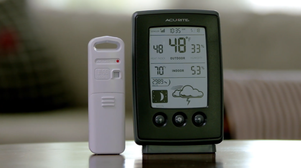
A weather station model tells us about the current state of the atmosphere and how it is expected to change over time. It can give us information on things like temperature, humidity, wind speed, and precipitation.
The most important thing to remember when reading a weather station model is that they are created using data from a limited number of weather stations. This means that they are not perfect and should be used as a guide rather than an absolute forecast.
Another important thing to remember is that weather models are constantly changing and being updated as new data comes in. This means that the forecast you see today might be different tomorrow.
How do you read pressure on a station model?
The pressure is always given in millibars (mb), and the value will be reported as a number with the leading 10 or 9 omitted.
You will initially be given a plotted pressure reading from a pressure sensor at a specific location. You will need to convert the pressure to millibars using the following table.
- 410: 1041.0 mb
- 103: 1010.3 mb
- 987: 998.7 mb
- 872: 987.2 mb
Besides that, you can also check a pressure trend by looking at the pressure tendency arrow. This is a good way to see if the pressure is rising, falling, or staying steady. The most important thing to remember when reading pressure is that high pressure means good weather and low pressure means bad weather.
How do you read wind in a weather station model?
Wind is always shown in knots in a weather station model. Each increment on the model equals five knots.
Wind speed is determined by adding up flags, lines or half-lines on the model. Flags are equal to 50 knots, while lines are equal to 10 knots and half-lines 5 knots.
For example, four flags and two lines would equal 40 knots (50+50+50+50+20).
To identify the direction the wind is blowing from, look at the ends of the symbol. The long end always points in the direction the wind is blowing from.
While this may seem confusing at first, with a bit of practice it will become second nature.
Useful Video: Reading a Weather Station Model
Conclusion
As you can see, reading weather station models is not as difficult as it may seem at first. With a little bit of practice, you’ll be able to quickly and easily interpret the data in these models to better understand the current and future state of the atmosphere. Just keep in mind that different variables will require to be read in different ways, and that you can always consult with a professional meteorologist if you have any questions about the data. Remembering where each variable is located will help you a lot. Now you can enjoy the weather with a whole new level of understanding!
I hope this guide was helpful in answering some of your questions about how to read weather station models. If you have any additional questions, feel free to leave them in the comments below and I’ll do my best to answer them. Until next time, happy model reading!
References
- https://www.shsu.edu/~dl_www/bkonline/GenRef111/Applets/Decode/L_decodestation.htm
- https://www.e-education.psu.edu/meteo3/l1_p5.html
- https://www.wpc.ncep.noaa.gov/html/stationplot.shtml
- https://wxobservation.com/how-to-read-a-weather-station-model/
- weather.gov/pqr/wind



Leave a Reply