

What is the weather going to be like tomorrow? Meteorologists have many tools that help them to create forecasts, but they rely on some more than others. It is important to know what these are in order to understand how accurate a forecast can be. We will discuss the most common meteorological tools below so you can understand what your local meteorologist does all day!
Table of Contents
8 Main Weather Tools
There are a lot of other tools meteorologists use to help create weather forecasts, but these are some of the most important.
Wind vane
A wind vane is a device that is used to measure the wind direction. This device consists of a vane that is placed horizontally on the weather station. The wind direction can be determined by observing where the edge of the blade points in relation to an orientation arrow.
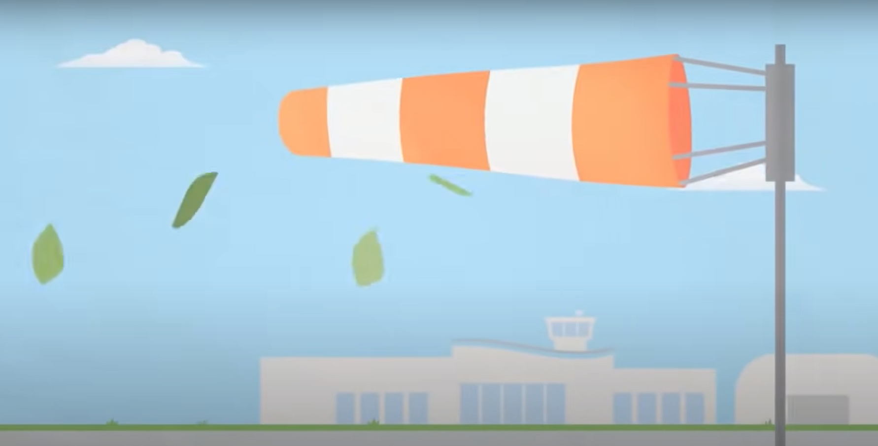
A wind vane uses the wind to move a pointer on a scale indicating air pressure, temperature, and humidity.
Wind vanes are used when there isn’t yet any data available for other methods like electronic sensors or satellite images.
Anemometer
The anemometer is a device used to measure wind speed. It works by measuring the deflection of wind against a known object. The anemometer is common among meteorologists who are hoping to predict weather patterns based on the velocity and direction of winds.

Anemometers typically have three or four “cup”-like cups that spin around in order to measure speed, which is then further connected via thin metal wires into an electric current for processing purposes. Different cup sizes can be used depending on the desired accuracy–the larger the size, the less sensitive it will be because there will be fewer cups spinning at any given time; conversely, smaller sized cups would provide higher levels of accuracy but only if they were able to spin faster due to their reduced size. Meteorologists must take this tradeoff between accuracy and speed into account when choosing the size of anemometer they will use for a particular project.
Anemometers are typically placed on top of tall towers in order to get accurate readings, but if not present meteorologists may instead place them atop mountains or other high points around their area in order to achieve similar results.
Barometer
A barometer measures atmospheric pressure. A decrease in air pressure means that a storm is on the way, while an increase suggests good weather will come soon after.
A meteorologist can use an aneroid barometer or a digital one to measure atmospheric pressure. It works by measuring the weight of air particles against a metal spring.

There are a few types of barometers. The traditional mercury barometer measures air pressure using a column of mercury inside a glass tube. But it requires regular cleaning because of its use of mercury. A meteorological instrument that uses this method is called a mercurial barometer or simply just a “mercury.”.
Another type is the aneroid barometer, which uses metal disks that contract or expand based on atmospheric pressure to measure changes in weather conditions through levers and gears.
A third option is a digital barometer, which looks similar to a computer mouse since it doesn’t use liquid at all to determine air pressure measurements. Digital weather stations are one way for meteorologists to check atmospheric pressure with ease and convenience. They can also include temperature readings as well as other information about current conditions outside which makes them ideal for tracking short-term forecasts on an hourly basis at most.
Thermometer
A thermometer is an instrument used for measuring temperature. A mercury-in-glass or alcohol-in-glass thermometer measures the change in the volume of a liquid, which indexes how much heat it has absorbed or given off. The size of the liquid column can be read by looking through an eyepiece at its highest point, while graduations along with the tube show changes in its height during heating and cooling. Many thermometers measure temperature via a property of electrical resistance, while others work by measuring the thermal radiation emitted from an object.

Thermometers are also used for weather balloons that go into the lower atmosphere, where they can measure air temperature at different heights. The height of each measurement is marked on the side of the balloon before it is let loose and recorded when it returns to Earth after its trip up through an intense cold front or other disturbance which may produce widespread cloudiness or showers.
Once back on ground level, meteorologists use these measurements along with any available surface observations such as wind speed and direction, humidity levels, barometric pressure readings, etc. They are all measured simultaneously by units placed around airports and cities across North America’s continents every six hours.
Hygrometer
The next tool is a hygrometer. A dry bulb thermometer and a wet-bulb thermometer are types of hygrometers that meteorologists use to measure humidity in the atmosphere.

A dry bulb thermometer is used to measure the temperature of the air.
The wet-bulb temperature, also called the wick index or psychrometric ratio, helps meteorologists determine if there is enough moisture in the atmosphere for precipitation to occur.
The wet-bulb temperature is determined by comparing the dry and wet bulb temperatures. If there isn’t a difference, then it doesn’t look like rain because air cannot hold much moisture without becoming saturated.
Otherwise, if there is a big enough difference in the two readings, then precipitation will likely occur soon because of how moist the air is.
As humidity in the atmosphere increases, it becomes harder to predict weather patterns since more moisture creates unstable conditions. A high level of humidity can lead to problems for people with respiratory issues or health concerns too.
The relative humidity is what they’re measuring, which is how much water vapor there is compared to the maximum amount of water vapor possible at that temperature.

Hygrometers work by measuring the change in electrical properties of certain materials. They are very important because the relative humidity is needed to determine how hot, warm or cold it feels outside.
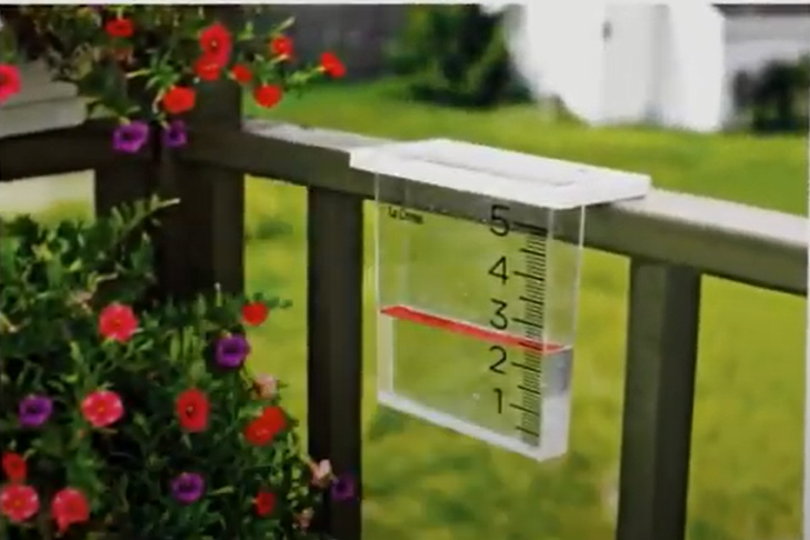
Rain gauge
A rain gauge is a tool that meteorologists use to measure how much it rains during certain periods. The amount of rainfall will play an important role in the weather forecast because if there are heavy amounts of rainfall then flooding can occur and wind speed measurements may be used for predicting tornadoes or hurricanes. One type of rain gauge that is commonly used by meteorologists measures precipitation based on each individual drop weighing 0.001 ounces (0.03 grams).
It works by measuring how much it rains in a specific period of time. When the rain gauge is full then this will trigger an alarm to let you know that there has been precipitation and when it reaches a certain level, usually up to half-full, then it can be emptied out by mouth or with water running through a pipe system attached underneath the rain gauge.
Satellite data
The last but not the least important tool meteorologists use is satellite data. Satellite images are used to collect real-time measurements of the atmosphere and oceans that influence weather patterns.
Data from satellites such as Geostationary Operational Environmental Satellites (GOES) help in forecasting short-term events like tropical storms, flash floods, dust devils, and dangerous thunderstorms. The GOES tracks rainfall distribution across a large region by emitting microwaves that bounce off water molecules in clouds and atmospheric particles; it then sends back information about their movements for further analysis.
The longer range forecasts require more precise observations taken over several hours or days with high-resolution instruments like polar-orbiting and geostationary operational environmental satellites (POES). These can be three-dimensional views of how air flows within the atmosphere which helps meteorologists to model and understand the behavior of major storm systems.

The shortest range forecasts are made using data from weather balloons that rise into the air where they can collect information about temperature, humidity, wind speed, and direction as well as atmospheric pressure at different altitudes. This high-altitude data is used by meteorologists to predict thunderstorms with greater accuracy up to two hours in advance since it gives more accurate measurements than readings taken on ground level or through satellites.
Meteorologists also use radar images for short-term forecasting like rain advisories or severe thunderstorm warnings within a time period ranging between 30 minutes and an hour before storms hit any specific area. The precipitation echoes return much faster when compared with satellite imagery.
In addition to this, meteorologists also use weather balloon data from a network of surface stations across the country which helps them in local forecasts. These balloons are launched twice a day and provide information on temperature, humidity, pressure, and winds at different altitudes just before they burst into thin air. This helps forecasters predict upcoming events like fog or thunderstorms in a particular area.
FAQ
What are weather reports?
Weather reports are forecasts that meteorologists create to inform people of what the weather will be like in a certain location. They can also use this information to make decisions about whether or not they should cancel school, work, and outdoor events due to inclement weather conditions.
Why is it important to forecast the weather?
Forecasting the weather is important because it allows meteorologists to prepare people for dangerous conditions, such as hurricanes or tornadoes. It also helps them decide whether or not a school should be closed due to snow and other winter weather concerns.
How does the weather forecast help a fisherman?
The weather forecast helps fishermen by giving them information about how the wind direction will affect fishing conditions. The meteorologist could also tell the fisherman what to expect in regards to high and low tides, which can help with their catch.
What is weather forecasting short answer?
Weather forecasting is predicting what the weather will be like in a certain location. Meteorologists make their forecasts by using tools such as radar and satellites to observe different atmospheric conditions.
Useful Video: How do Meteorologist predict the weather?
Final Thoughts
There are many tools available to meteorologists in order to create weather forecasts. Whether they’re using desktop software or mobile apps, these professionals need the right technology by their side in order to produce accurate data and predictions for people across the world.
We hope this blog post has given you a better understanding of the tools meteorologists use in order to help people keep safe when severe weather happens.
You can find more helpful articles like this one by visiting our website today!